

Key Takeaways
New Zealand's Tectonic Geography
New Zealand sits directly on the boundary between the Australian and Pacific tectonic plates, creating an unusually compressed collision of landscapes. This active geological setting produces volcanoes, earthquakes, glaciers, fjords, and geothermal fields — often within a few hours' drive of one another. The result is a country roughly the size of Colorado that contains environments as diverse as those spread across an entire continent.
The boundary runs diagonally through both main islands: the South Island's Southern Alps were thrust upward by plate compression, while the North Island's volcanic plateau reflects subduction-driven magma activity below the surface.
Two Plates, One Extraordinary Country
Most countries can claim a signature landscape — a desert, a coastline, a mountain range. New Zealand claims all of them simultaneously. The reason is geological: the country straddles the boundary between the Australian Plate and the Pacific Plate, two massive sections of Earth's crust pushing against each other at roughly 40 millimeters per year. That slow, relentless collision is the engine behind everything dramatic you'll see here.
On the South Island, the plates collide head-on, forcing rock upward into the Southern Alps — a spine of peaks running nearly the full length of the island, with Aoraki/Mount Cook reaching 3,724 meters. On the North Island, the Pacific Plate slides beneath the Australian Plate in a process called subduction, generating magma that fuels the country's volcanic heartland. Same boundary, two completely different expressions.
40mm
Annual plate movement rate
The Australian and Pacific plates converge at approximately 40 millimeters per year, according to GNS Science, New Zealand's geological research institute.
3,724m
Height of Aoraki/Mount Cook
New Zealand's tallest peak, formed by tectonic uplift along the Alpine Fault on the South Island.
14,000+
Earthquakes recorded annually in NZ
GeoNet, the national geological hazard monitoring system, records thousands of earthquakes each year, though most are too small to feel.
The Volcanic North Island
The central North Island sits within the Taupo Volcanic Zone, one of the most geothermally active regions on the planet. Lake Taupo itself occupies the caldera of a supervolcano whose massive eruption roughly 1,800 years ago was recorded as far away as China and Rome through atmospheric effects noted by ancient observers. Today the lake is placid and popular with swimmers — a remarkable contrast to its violent origin.
Rotorua, further north, is where the geothermal drama becomes immediately visible: bubbling mud pools, silica terraces, steam rising from roadside vents, and geysers erupting on schedule. The landscape there looks like another planet, and it offers one of the most visceral reminders that the ground beneath New Zealand is very much alive.
Check Volcanic Alerts Before You Visit
New Zealand's GeoNet website publishes real-time volcanic alert levels for all active volcanoes. Before visiting areas like Tongariro National Park or White Island, check the current alert status. Conditions can change with little warning, and park access may be restricted during elevated activity periods.
Glaciers, Fjords, and the Southern Alps
Cross Cook Strait to the South Island and the geology shifts character entirely. The Southern Alps create a dramatic rain shadow: the West Coast receives some of the highest rainfall in the Southern Hemisphere, while Canterbury on the eastern side stays comparatively dry. That moisture feeds Franz Josef Glacier and Fox Glacier, two rivers of ice that descend unusually low — nearly to rainforest level — because of the relentless precipitation.
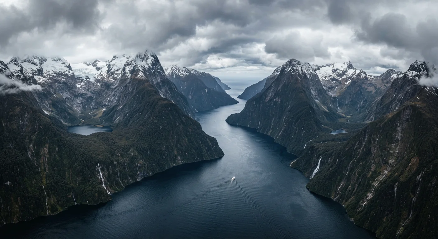
Further south, Fiordland National Park preserves the product of a different era. During the last Ice Age, massive glaciers ground through the landscape, deepening valleys to extraordinary depths. When those glaciers retreated, the sea rushed in, creating the fjords — Milford Sound, Doubtful Sound, Dusky Sound — that make Fiordland one of the most dramatic coastal landscapes anywhere on Earth. Much like the volcanic terrains of Iceland's interior, described in our look at Iceland's Ring Road circuit, the contrast between ice-age legacy and living geology is what makes these places feel so singular.
What This Means for the Traveler
Understanding the geology doesn't just satisfy curiosity — it changes how you experience the country. When you stand at Milford Sound and look up at walls of rock rising 1,200 meters straight from the water, you're seeing the aftermath of millions of years of uplift and glacial erosion. When you hike the Tongariro Alpine Crossing past rust-colored volcanic craters and emerald crater lakes, you're walking across an active subduction zone. The landscape isn't just scenery; it's a story still being written.
New Zealand's geographical intensity also means conditions can shift quickly. Alpine weather on the South Island is notoriously unpredictable, volcanic alert levels on the North Island can change, and earthquake activity — while rarely catastrophic for visitors — is part of daily life. Staying informed through New Zealand's official GeoNet monitoring service and local civil defense resources ensures travel remains safe. Just as Atlantic coastal explorers planning trips to geologically diverse regions like those covered in our guide to the Canadian Maritimes find that understanding terrain shapes the journey, in New Zealand the geology is the journey.
Geology Affects More Than Scenery
New Zealand's tectonic setting also influences its soils, agriculture, geothermal energy production, and even its building codes. Wellington and Christchurch have both experienced major earthquakes in recent decades. The country has invested heavily in earthquake-resilient construction and public preparedness — context worth having when you arrive.